Burial Location
Lost grave (no longer extant), exact location unknown in “a corner” of SIMON BURN’s “Northern Boundary Farm, Field of Mars,” (North Parramatta), parish of St. John’s, Parramatta.
Notes
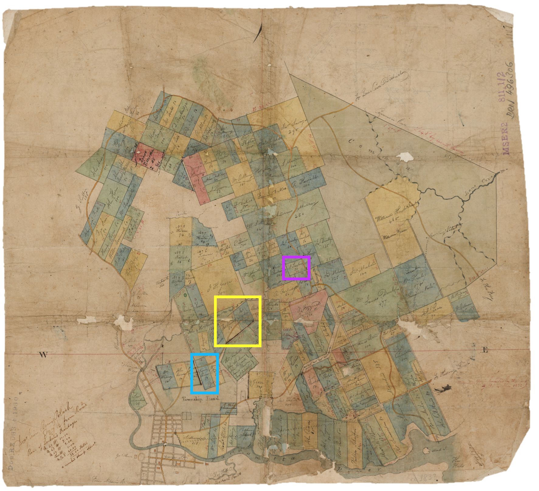
The former “Burn Farm” was located on “Lot 38,” which was bordered on the north by Pennant Hills Road, James Macarthur Crescent to the west (Bellevue Street also terminates roughly on the western boundary), and Belmore Street served as the farm’s southern boundary. If Webb Street continued northwards to Pennant Hills Road, it would run closely parallel to the eastern boundary of the Burn allotment. James Ruse Drive cuts diagonally right across what was once Simon Burn’s farm.
Source: David Collins, An Account of the English Colony in New South Wales, Vol. I, (The Strand, London: T. Cadell Jun. and W. Davies, 1798), p. 393.
Parish Burial Register
Biographical Content
Michaela Ann Cameron, “The Killing and Keening of Simon Burn,” St. John’s Online (2020).
Citation
St. John’s Online (stjohnsonline.org), “Memorial: Simon Burn’s Lost Grave at ‘Burn Farm: Lot 38,’ Northern Boundary Farms, Field of Mars (North Parramatta),” (0.0.A), (2022), https://stjohnsonline.org/memorials/0-0-a/, accessed [insert current date]
© Copyright 2022 St. John’s Online
